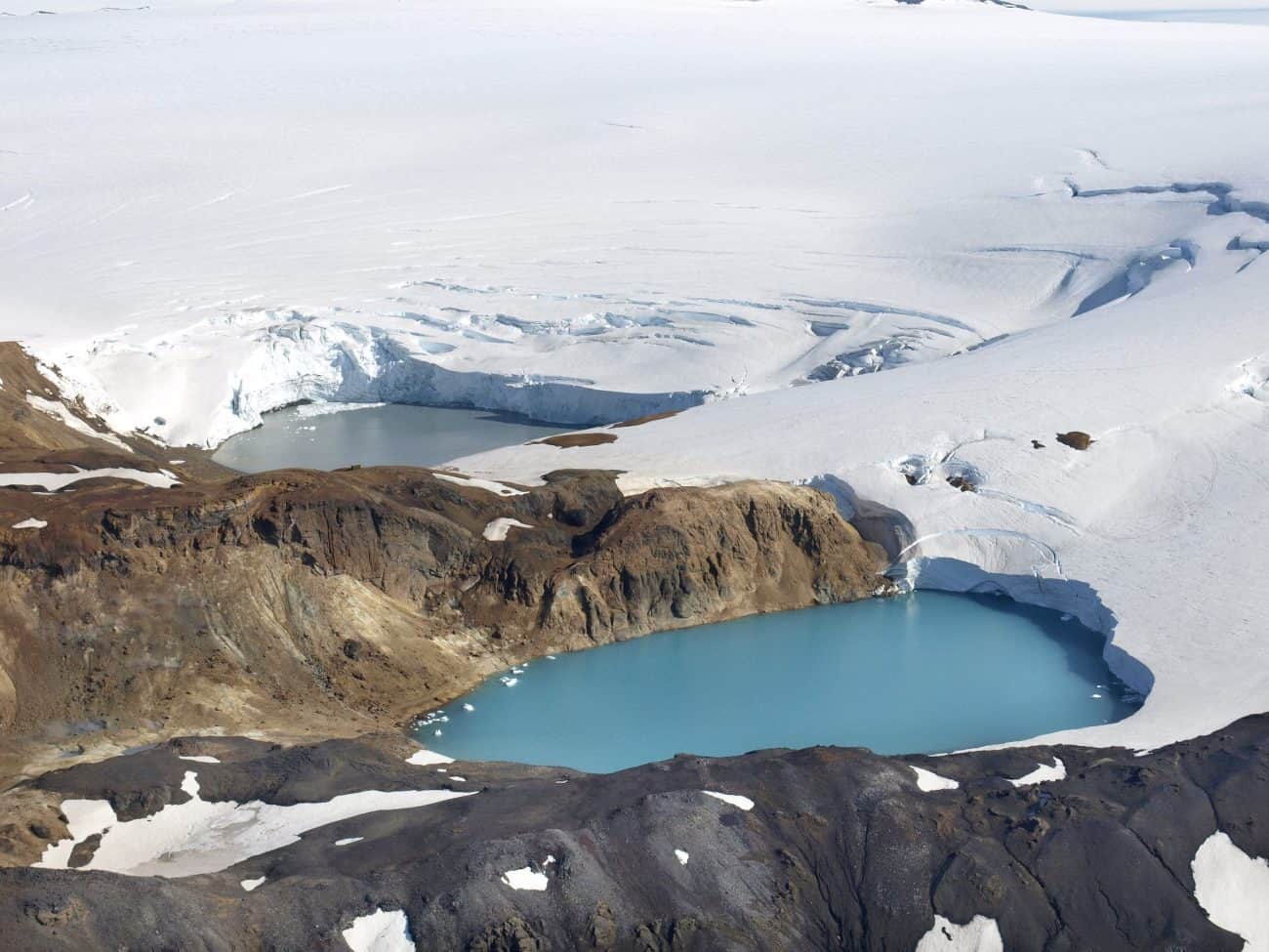
Deep within Iceland’s highland desert interior, Kverkfjoll is Iceland’s second-highest volcano. Kverkjokull glacier splits the volcano. It has burrowed out a deep valley in rich hues of red, black and green.
Kverkfjoll is part of Vatnajokull National Park. The Kverkfjoll mountain range is a cluster of peaks formed by a volcano on the Vatnajokull ice cap. It is the third highest mountain range in Iceland after Oraefajokull and Bardarbunga. Large, hot magma chambers hidden underneath the mountains lead to astoundingly beautiful glacial ice caves. Please note that the weather and glacial conditions around ice caves can be dangerous. We recommend that you visit the area with a local guide.
Massive glacier tongues extend from the Vatnajokull ice cap on both sides of the Kverkfjoll Mountains, while the glaciers Dyngjujokull and Bruarjokull lie to the west and east.
The highest peak is Skarphedinstindur (1.936 m/6.352 feet) on the range’s eastern part. Moreover, the Kverk pass divides the mountain range into eastern and western halves. Kverkjokull glacier flows outwards via the pass to the north-west down to the highland plateau, which is approximately 900 m (2.953 feet) above sea level.
The Kverkfjoll Volcano
Geologists believe that two calderas below the ice formed part of the Kverkfjoll Ridge. A glacier covers the caldera to the south. On the other hand, the northern caldera is now mostly ice-free.
Geothermal energy in Kverkfjoll
One of Iceland’s most active high-temperature geothermal areas is in the western Kverkfjoll Mountains. An area of hot springs 3 km (1.9 miles) long and nearly 1 km (.06 miles) wide sits at an altitude of 1600-1700 m (5.249 – 5.577 feet). Hveradalur valley lies in the uppermost and southernmost part of the area, separated from the Lower Hveradalur Valley by the Threngsli pass. Gamur, one of Iceland’s most powerful geysers, sits in the northern part of the pass. A hiking trail from the Kverkjokull glacier slants up the Langafonn slope onto the ridge and along its edge to the Icelandic Glaciological Society cabin.
Getting to Kverkfjoll
Historical evidence suggests that people traveled across the Vatnajokull ice cap in the Middle Ages. The glacier was somewhat smaller at that time. The route probably lay just east of the Kverkfjoll Mountains. In 1910, a German geologist named Trautz became the first person to scale these peaks.
Icelanders built a bridge over the Kreppa in 1970 as part of a track across the Hvannalindir area and through the Kverkhnjukaskard pass to the Kverkfjoll Mountains. They also built a mountain cabin in an old crater on the slopes of Mt Virkisfell in 1971.
The Austurleid, or the East Route (Mountain Road F910), passes to the west of the Odádahraun crossing a bridge over the River Jokulsa a Fjollum. The Kverkfjoll track (Mountain Road F902) branches south to Kverkfjoll. The Austurleid continues east to Krepputunga, where another track (Mountain Road F903) leads from Kreppuhals to Hvannalindir.The roads leading to Kverkfjoll are only open during the summer months. You must have a 4WD vehicle with good suspension and a high carriage to handle the rugged, unpaved mountain roads. There is a park ranger station at Kverkfjoll. Here you can learn about the area and find out the latest trail conditions. Accommodation in the area includes camping and mountain huts, which must be reserved in advance.
Important: Please note that the weather in Kverkfjoll and nearby area can change without notice. Fog, storms, and sandstorms can take hikers by surprise.
GPS: N64° 44,850 W16° 37,890